Publication | Trailblazers: Two Case Studies for Community Trails
Publication | Trailblazers: Two Case Studies for Community Trails
COMMUNITY TRAILS THAT WORK
Trails function as beneficial resources for communities in support of their various goals; although how projects are implemented and what specific features are created will differ depending on a community’s geographic location, socio-economic context and potential, and historical and cultural assets. While the essence of a trail project may seem simple and universal in nature, different communities with different contexts, shapes and sizes can apply a range of trail planning strategies and approaches to fit their needs and physical community. Ultimately, each community’s trail project will differ from their neighbor’s as well as from the perceived “ideal” trail. In any event, communities should be proud of their trail project accomplishments. This case study review builds on the previous Beyond a Path 1 and Beyond a Path 2 documents.
Numerous communities have creatively and effectively embarked on partnerships with outside agencies to fund and implement trails and greenway projects as public resources. Shared visions between public and private partners have helped communities to use limited resources wisely through phased planning and implementation. From a long-term perspective, larger visions can guide communities to get the projects rolling. Furthermore, understanding the local land use policies and zoning ordinances, and overcoming any existing procedural challenges are other aspects to consider for trail implementation.
The following two communities have successfully planned, designed, and implemented trails and greenways in different time lines, contexts and processes. Both projects share a range of trail project features, lessons learned and processes that can be adapted to be suitable for other locations, contexts, communities and cultures whether old or new, urban or rural, or large or small. These communities identified and utilized their natural resources to address potential issues prior to a disruptive event such as a flood or protected natural resources that were up against development pressure. Trail systems and greenway projects can be used to proactively propose alternative solutions that balance human needs with ecosystem processes which benefit both the communities and the larger region.
ELIZABETHTOWN GREENBELT, HARDIN COUNTY, KENTUCKY
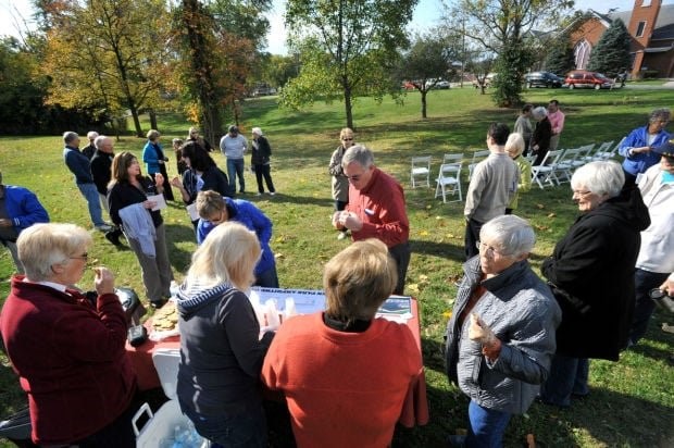
The Greenbelt is a system of trails, parks and open spaces located around three lakes and inflow streams in Elizabethtown, Kentucky. The greenspace and adjacent riparian area and watershed are recreational, ecological, educational, historical and aesthetic assets that help preserve the natural features of the local community. Greenspace, Inc., a non-profit group, has been acquiring land since the 1970s to protect the local waterways and for the past four decades has developed and extended a greenway which includes a network of trails. Through a partnership, the City Parks Department supports maintenance while Greenspace, Inc. continues its mission to further extend and sustain the trail system (Greenspace, Inc., 2014). As a result of a long-term community commitment, the Elizabethtown Greenbelt provides valuable recreational opportunities to the residents and the trails connect destinations within the community (Figure 1).
Figure 1. Master plan of Elizabethtown Greenbelt Trail System as of 2013.
Source: Greenspace, Inc., 2013

In the case of Elizabethtown, the city’s land use code and zoning ordinance do not restrict where parks and open spaces can be located under certain land use categories. Several classifications list government operated parks as an acceptable use and do not strictly limit where public parks and trails can be located which allows residential and planned neighborhood residential areas to also include greenspace and trails (City of Elizabethtown, 2004; City of Elizabethtown, 2015). This flexibility in local land use and zoning policies allows the local government to permit extension of trails for subsequent sections while awaiting funding availability to futher build on the existing system whether from internal or external sources. The Elizabethtown Greenbelt is an example of a long-term incremental strategy successfully embarked on by community members through a partnership to use limited resources wisely. As a reference, Table 1 summarizes the Greenbelt project.
Table 1. Elizabethtown Greenbelt Case Study Summary
Source: Greenspace, Inc., 2013; Greenspace, Inc., 2014
Project Name: Elizabethtown Greenbelt
Location: Elizabethtown, Kentucky
Date Planned: Since 1970 (on-going)
Construction Completed: 1974-present (on-going)
Estimated Cost: Not Available. Major operating costs include salary of maintenance crew and materials for features (bridges, signs, benches, etc.)
Size/Length: 18 miles
Landscape Architect/Planner: The City of Elizabethtown, Planner
Consultant(s): The City of Elizabethtown
Managed By: Greenspace, Inc., The City of Elizabethtown
Project Background and History: The project is a result of a flood control project from the 1970s to also preserve Elizabethtown’s natural resources and provide recreational opportunities.
Design, Development, Decision Making Processes: Concept plan was adopted by the city, leading to the introduction of Greenspace, Inc. which has since collaboratively maintained and developed other trails and greenspaces.
Program Elements: Series of walking trails and parks encompass a number of lakes and streams in the area
Significance: Preservation of natural features/ resources such as local waterways
Limitations: Limited funding
Future Concerns: Funding and maintenance of the potentially expanding system
PARKLANDS OF FLOYDS FORK, LOUISVILLE METRO REGION, JEFFERSON COUNTY, KENTUCKY
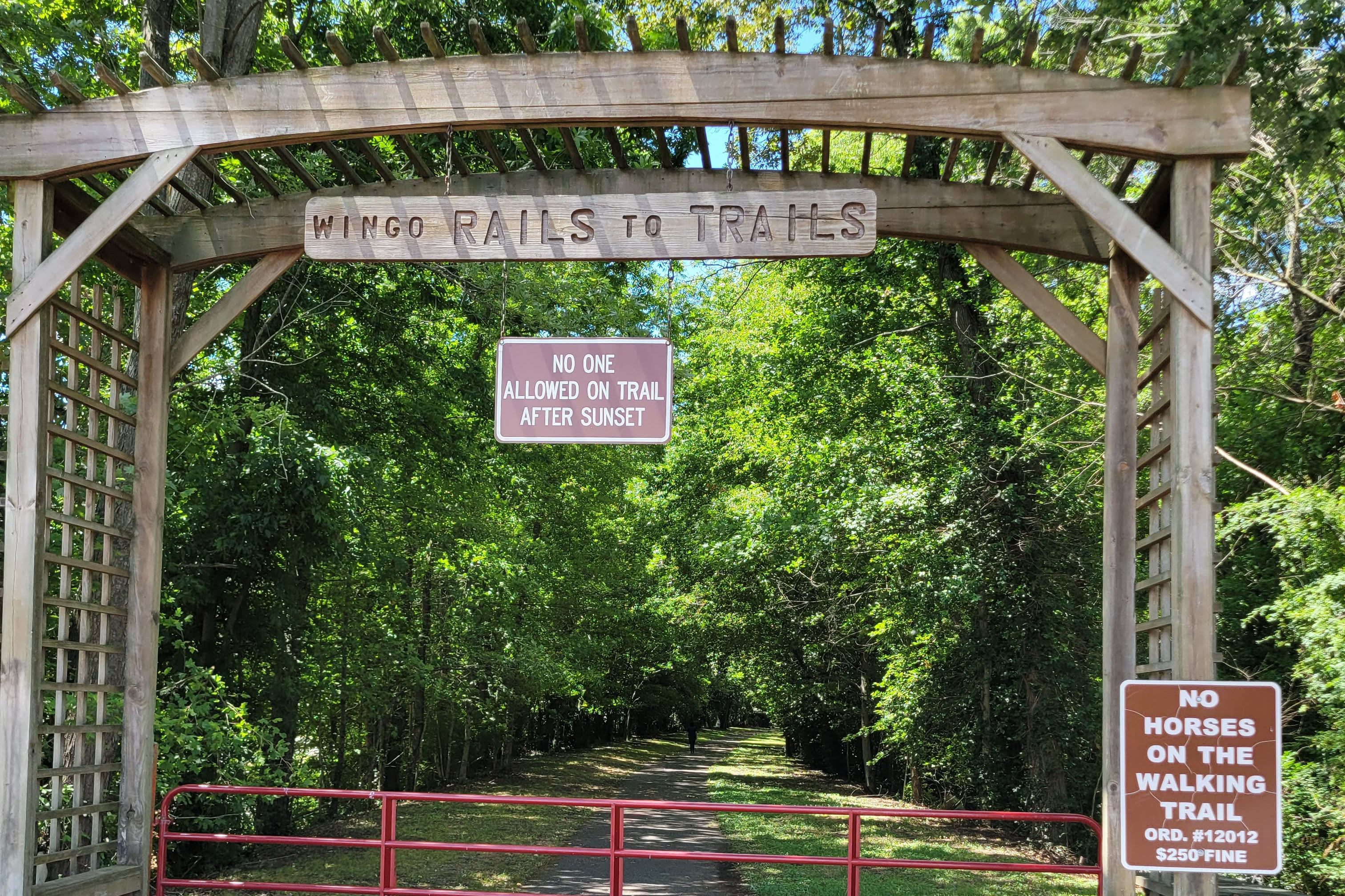
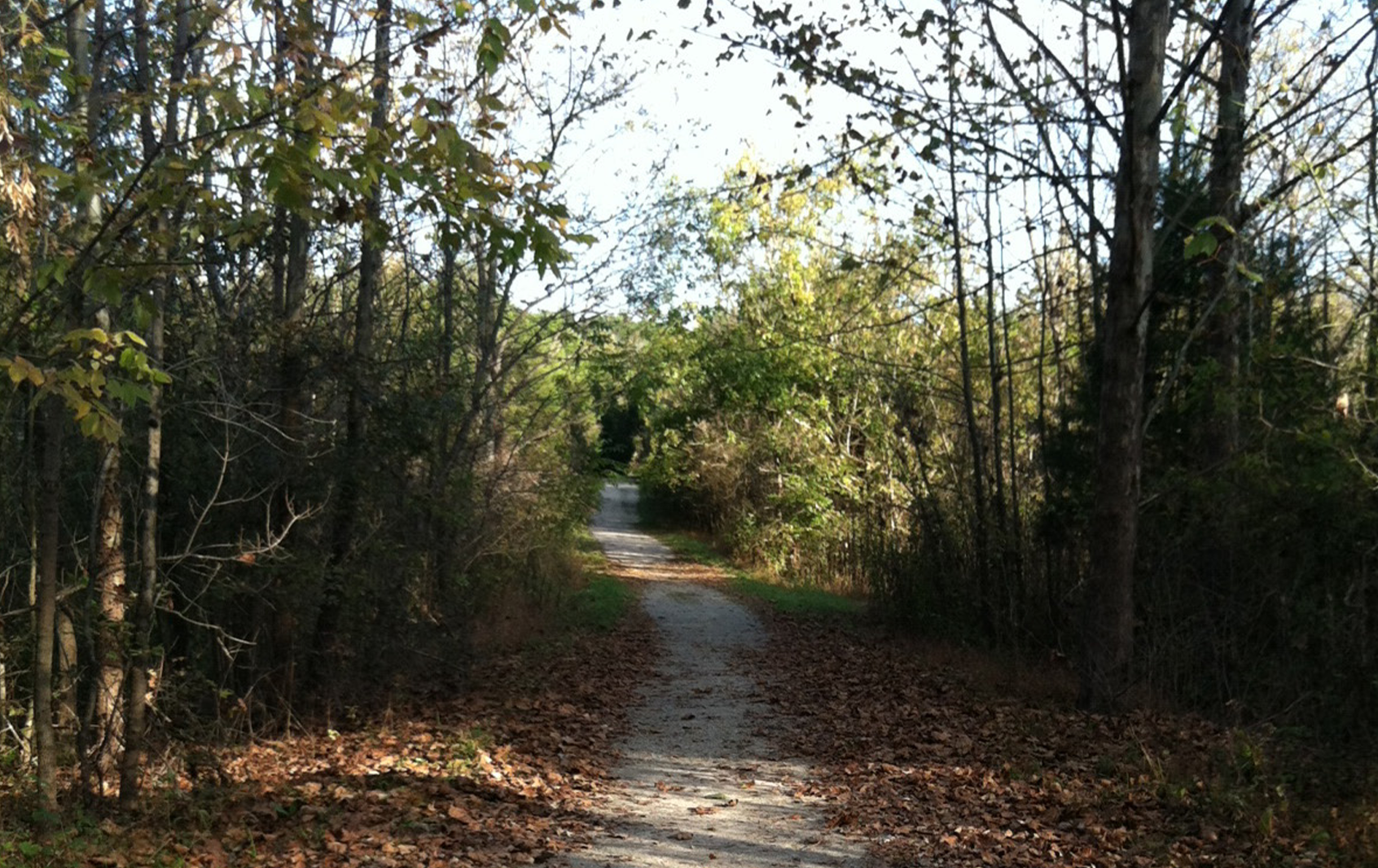
In 2005, 21st Century Parks, a nonprofit organization located in Louisville, Kentucky, initiated the Floyds Fork Greenway Plan. The plan and design of the greenway was finished in 2008 and as of 2015 three out of the five planned park areas within the Parklands of Floyds Fork are open to the public and include a range of trails for hiking, biking, and canoeing (Figure 2).
Figure 1. Trail in Pope Lick Park in the Parklands of Floyds Fork.

Initially, the goal of the greenway was to provide two regional parks while protecting and preserving natural streams and forest land in the growing urban region. Floyds Fork Creek and its watershed on the eastern side of Jefferson County presented opportunities for an expanded park system that could restrict further encroachment from development. Water trails and walking/biking trails connect the parklands throughout the different parks along and adjacent to Floyds Fork Creek which eventually flows into the Ohio River (Wallace Roberts & Todd, LLC., 2009; 21st Century Parks, Inc., 2012).
The Louisville Metro Parks and Recreation Department deeded one of its parks to 21st Century Parks to further operate and maintain as a public park. Although the ownership changed, the non-profit organization is able to better manage this part of the public park system which includes the trail system through continuous donor support. At the regional scale, the greenway is also part of the 100 mile Louisville Loop which is a shared-use path system in and around Louisville, KY, and managed by the Metro Parks and Recreation Department (Louisville Metro Parks, 2013). As a reference, Table 2 summarizes the Parklands of Floyds Fork project.
Table 2. Parklands of Floyds Fork Case Study Summary
Source: Wallace Roberts & Todd, LLC, 2009; 21st Century Parks, Inc., 2012; 21st Century Parks, Inc., 2013
Project Name: Parklands of Floyds Fork
Location: Louisville, Kentucky
Date Planned: 2005-2008
Estimated Cost: $120 million
Size/Length: 46-mile trail and parks system/greenway, approximately 3,000 acres of land
Landscape Architect/Planner: Wallace Roberts & Todd; Biohabitats, Inc.; Eco-Tech, Inc.; John, Milner Associates; HNTB; and Burgess and Niple
Client: 21st Century Parks, Inc.; Louisville Metro Parks; and The Future Fund, Inc.
Managed By: 21st Century Parks, Inc.
Project Background and History: 21st Century Parks, Inc., raised public and private funds to plan and design the Parklands of Floyds Fork project to offer recreational and educational opportunities while also providing environmental and ecological benefits in the thriving metro region as part of Louisville’s park and trail system. The non-profit manages this segment of the metro’s parks and trail system.
Program Elements: The Parklands includes four major parks connected by a trail system along the Floyds Fork and includes other recreational facilities.
Significance: The donor-supported public park system includes trails that connect throughout the eastern side of Jefferson County and hosts a wide range of activities in addition to enhancing ecosystem services.
Limitations: Need to continuously raise funds to maintain the greenway/trail system
Future Concerns: Continued maintenance of features and facilities
CONCLUSIONS
Trail projects are context sensitive and are specific to the community that visions and creates them. In both case study projects, non-profit organizations advocated for and shared responsibilities for supporting and maintaining the public spaces. Consideration of natural resources was necessary in order to prevent future environmental degradation and protect them from development pressure. The trail systems and greenway projects proactively proposed alternative solutions that addressed multiple goals ranging from environmental to recreational. Both projects worked to protect the quality of natural resources, encourage healthier behaviors, provide pleasant recreational opportunities, and encourage tourism while also having the potential to enhance property values. Although the Elizabethtown Greenbelt project shared some of the expansion costs and operations with a public entity, the Parklands of Floyds Fork is 100% donor-supported. Furthermore, guided flexibility in local land use and zoning policies can encourage creation of greenspaces that facilitate connectivity. However, these types of projects require intentional planning and design that will address the needs and visions of each community. Overall, these communities were able to effectively utilize their natural resources to enhance quality of life. While these case studies highlight trails, the concept and project specifics can apply to any Kentucky community large or small.
FURTHER RESOURCES
Department of Local Governments
Provides grants for projects ranging from the acquisition of property to the installation of public infrastructure. Also provides assistance for neighborhood revitalization and expansion of affordable housing opportunities.
Kentucky Trail Towns, Office of Adventure Tourism, Department of Travel
http://www.kentuckytourism.com/outdoor-adventure/sites-services/trail-town/
Details how communities can become a trail town through proper organization, design, economic restructuring, and promotion.
National Park Service (NPS), Rivers, Trails, Conservation Assistance (RTCA)
http://www.nps.gov/orgs/rtca/index.htm
Provides technical assistance for communities visioning or working on protection of or creation of recreational resources and opportunities in their regions.
Kentucky Transportation Cabinet
http://transportation.ky.gov/Bike-Walk/Pages/Trails.aspx
Implements federal funding that applies to enhancement of pedestrian/bicycle paths and is managed by the state.
US EPA
Various resources, funding opportunities for enhancing environments while protecting the health of communities.
US Forest Service (USFS)
Provides information and guidelines for trail design and management.
Federal Highway Administration (FHWA), Recreational Trails Program (RTP)
http://www.fhwa.dot.gov/environment/recreational_trails/index.cfm
Provides funds to the states to develop and maintain recreational trails and trail related facilities for both non-motorized and motorized recreational trail uses.
REFERENCES
City of Elizabethtown. (2004). Comprehensive Plan. Retrieved from http:// www.elizabethtownky.org/planningdevelopment.asp City of Elizabethtown. (2015). Zoning Ordinance. Retrieved from http://www.elizabethtownky.org/planningdevelopment.asp
Greenspace, Inc. (2013). Trail Map. Retrieved from http://www.greenspaceky.com/trail-map.asp
Greenspace, Inc. (2014). Greenspace, Inc. Retrieved from http://www.greenspaceky.com/greenspace-inc.asp
Louisville Metro Parks. (2013). Louisville Loop Master Plan: Connecting People to a Greener Healthier Community. Retrieved from https://louisvilleky.gov/government/louisville-loop/louisville-loop-master-plans
Wallace Roberts & Todd, LLC. (2009). ASLA 2009 Professional Awards, Analysis & Planning Category Honor Award: The Floyds Fork Greenway Master Plan, Louisville, KY. Retrieved from https://www.asla.org/2009awards/572.html
21st Century Parks, Inc. (2012). 2012 Annual Report: Experience Countless Spectacular Views. Share in One Amazing Vision. Retrieved from http://www.theparklands.org/21stcentury-parks.html
21st Century Parks, Inc. (2013). 2013 Annual Report: It’s time for Louisville to come outside and play. Retrieved from http://www.theparklands.org/21stcentury-Parks.html
Related Information